Geographic Information Systems -Available Maps
The GIS Department has many standard maps for sale. To purchase a map, please fill out the Map Ordering Form and mail, fax or email it to the GIS Department, or come by the office, located at 100 W Public Works Dr in Shelton. Do not fill out the billing information. The GIS Staff will fill out the billing information after we receive your request and let you know what the cost will be. Custom Map Ordering Form |
|
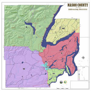
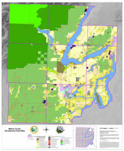
| 36” x 36” This general map of the county shows Addressing Districts. Major water bodies and roads are shown and labeled for reference. This map was updated July 2012. |
|
$18.25 Each |
|
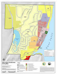
| 17” x 22” portrait This map shows the Allyn UGA zoning and was produced in 2007 and was updated in March 2022. |
|
$16.50 Each |
|
Belfair Water District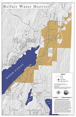 |
22"x34" Portraint This is a detailed map of the Belfair Water District. Property parcel boundaries, roads and large water bodies are shown for reference. This map was created in January 2013. |
| $16.50 Each | |
| 17" x 22" Portrait
This map shows the Belfair UGA Zoning. This map was update 10/18/2023. |
|
$16.50 Each |
|
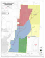
| 34” x 44” landscape This maps shows the boundaries of the Belfair Sewer System Connection Zones and was created in April 2008. It is a copy of the official map signed by the commissioners. |
|
$18.50 Each |
|
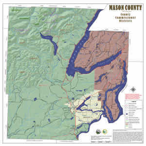
| 36” x 36” This basic map of the county shows the boundaries of the three Commissioner Districts. Major water bodies and roads are shown and labeled for reference. This map was updated in July 2012. (These districts were adopted by the Mason County Commission on August 9th, 2011, resolution 51-11.) |
|
$18.25 Each |
|
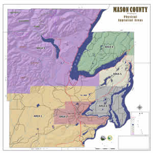
41” x 50” portrait |
|
$25.00 each |
|
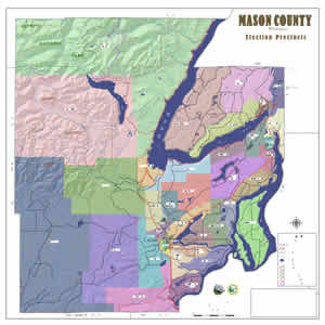
| 36" x 36" This map shows the Election Precincts. These precincts were adopted by the Mason County Commission on March 29, 2022. |
|
$18.25 Each |
|
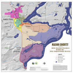
| 36" x 36" This map shows the Election Precincts in the 10th Congressional District. These precincts were adopted by the Mason County Commission on January 17th, 2012. |
|
$18.25 Each |
|
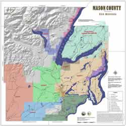
| 36” x 36” This general map of the county shows Fire Districts. Major water bodies and roads are shown and labeled for reference. This map was updated September 6, 2023. |
|
$18.25 Each |
|
Hospital Districts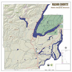 |
36" x 36" This general map of the county shows Hospital District boundaries. Major water bodies and roads are shown and labeled for reference. This map was updated in July 2012. |
| $18.25 Each | |
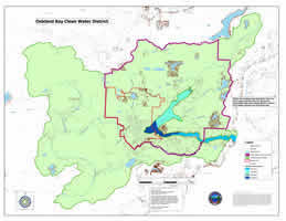
| 34” x 44” landscape This map shows the Oakland Bay Clean Water District boundary and was created in May 2007. |
|
$18.50 Each |
|
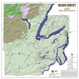
| 36" x 36" This is a general map of the county showing the location of County Parks & Facilities. This map was updated in January 2013. | |
$18.25 Each |
|
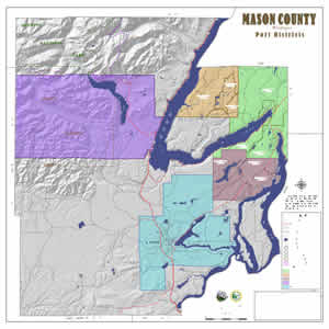
| 36" x 36" This general map of the county shows Port District boundaries and Port Commissioner District boundaries. Major water bodies and roads are shown and labeled for reference. This map was updated in July 2012. |
|
$18.25 Each |
|
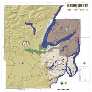
| 36” x 36” This general map of the county shows Public Utility District boundaries and PUD Commissioner District boundaries. Major water bodies and roads are shown and labeled for reference. This map was updated in April 2022. |
|
$18.25 Each |
|
36" x 36" |
|
$18.25 Each Each |
|
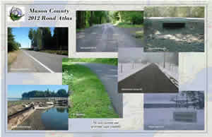
This atlas has been updated and improved for 2012. The atlas contains 18 regular and 28 detailed community maps. It also contains a map showing the various addressing districts in the county. The detailed community maps cover populated areas of the county like: Allyn, Belfair, Hoodsport, Shelton, Union and more. Other features included are: campgrounds, golf courses, parks, schools, libraries, fire stations, road name index, map page quick finder and more. This atlas is not designed to be a guide for US Forest Service or Logging roads. |
|
$30.00 Each |
|
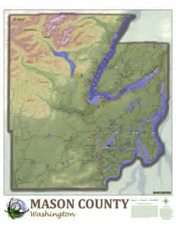
| 41” x 50” portrait (2013 Edition) This is a large detailed map of the county with most of the roads labeled. Water features, parks, towns, mountain peaks, and a few other points of interest are shown. Last updated August 2023. |
|
$25.00 Each |
|
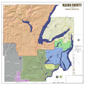
| 36" x 36" This general map of the county shows School District Boundaries. Major water bodies and roads are shown and labeled for reference. This map was updated in July 2012. |
|
$18.25 Each |
|
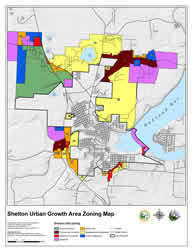
| 17" x 22" Portrait
This map shows the Shelton UGA Zoning. This map was update 3/16/2022. |
|
$16.50 Each |
|
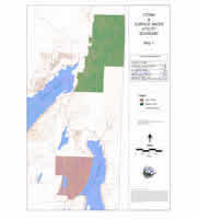
| 22” x 24” portrait This map shows the boundaries of the Allyn and Belfair Storm and Surface Water Utility and was created in June 2008. It is a copy of the official map signed by the commissioners. |
|
$17.00 Each |
|
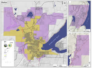
| 36" x 48" This basic map shows close-up views of the three Urban Growth Areas in the county: Shelton, Allyn, and Belfair. Major roads and water bodies are shown and labeled. This map was updated 3/16/2022. |
|
$20.00 Each |
|
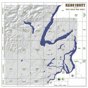
| 36" x 36" This general map of the county shows USGS Quadrangle boundaries for Mason County. Major roads and lakes are shown and labeled for reference. This map was updated in July 2012. |
|
$18.25 Each |
|
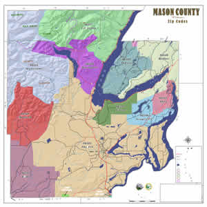
| 36" x 36" This general map of the county shows Zip Code Boundaries. Major water bodies and roads are shown and labeled for reference. This map was updated in July 2012. |
|
$18.25 Each |
|